How to look up a Tree Preservation Order or Conservation Area
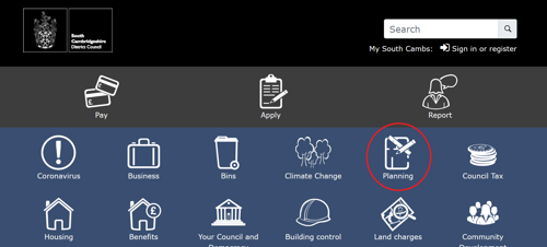
Start by going to the Council website, www.scambs.gov.uk, and choosing 'Planning'.
Choose ‘Search by map’.
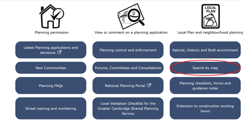
Scroll down the page.
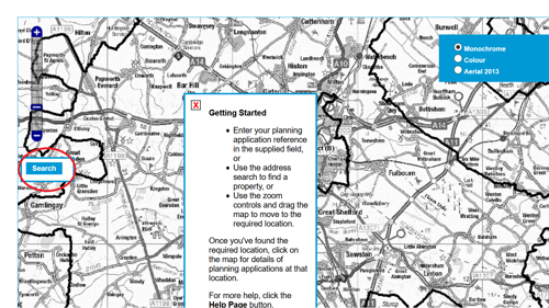
Turn off the ‘Getting Started’ pop-up with the little red cross. The menu is in the blue ‘Options’ button (middle left).
Before searching for a site, turn off the ‘Application’ layer by unticking the little box.
‘Search for an Address’ is at the bottom of the ‘Options’ menu. If you’re searching for a common address such as Mill Lane, High Street or Church Lane, add the village name.
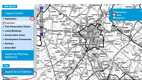
The address choices appear in the box underneath. Use the dropdown arrow to show all options and click the address you are looking for. If the address you want does not appear, try being less specific.
Turn on ‘Tree Preservation Orders’ by checking the little box to the right. ‘Conservation Areas’ can also be turned on this way. Tree Preservation Orders appear as shapes outlined in blue.
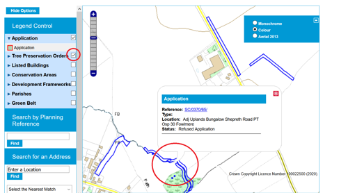
The style of map can be changed from black and white to an Ordnance Survey style or aerial photograph using the check boxes on the top right. Click on any blue shape to find out more about that shape. Clicking on the blue reference number provides the original TPO tree location plan.

